What a wonderful world
Even before starting our holiday, we
had
discussed whether we should make reservations for the West Coast Trail.
We had
already heard a lot about this trail. It is considered one of the most
difficult and demanding trails.
We
decided not to make reservations
and to just risk it. We had selected the Juan de Fuca Trail as an
alternative.
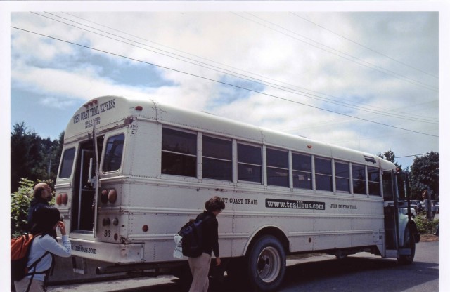
The trail bus from Victoria was booked for the 31 July. We wanted to start at the south end of the trail in Port Renfrew, i.e. on the Gordon River.
The evening before the
trip, we went
through the contents of our rucksacks and sorted out everything we
thought we
didn’t need on it, uncompromisingly. What we didn’t
need could be stored in the
hostel in Victoria.
Thus,
although the rucksacks were
heavy, we could still carry them.
The bus left the Victoria bus station at 6.40. This meant getting up early – too early to be able to get a breakfast.
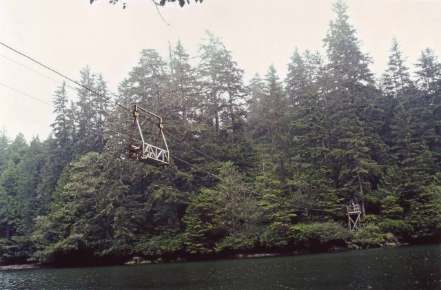
The bus was rather full. It looked as if most of the passengers had a definite reservation for the trail for today. Actually, we want to go on the West Coast Trail but what happens if it is really so difficult and we don’t make it? The number of passengers with us made it seem likely that we wouldn’t have to try out our strength on the West Coast Trail. The time passed slowly. The bus reached Port Renfrew. As we passed, the driver showed us the ancient general store. I remembered that we needed spirits for the stove. On arrival at the visitors’ centre, the first thing we needed was a coffee – which turned out to be cocoa. No matter! After all, we were already awake. When we finally arrived at the hut, the others were already there and were filling out their forms. We told the ranger on duty that we didn’t have reservations. We expected her to shake her head regretfully and say that everything was already full for that day.. Instead of doing that, she asked us whether we wanted to take the 11 o’clock or one o’clock ferry. We were caught in a trap. Our fears of not getting a place had not vanished but, in this situation, we dare not express them. Of course, we wanted to take the 11 o’clock ferry. Annette’s objection that we still needed to get spirits for the cooker was met with the remark ‘No problem, we have spirits here’. So there was nothing we could do but fill in the form, like the others. We decided to allow 7 days for the 75 km trail.
While we were still filling out the form, the ranger gave the obligatory talk on the trail, its condition, bears, pumas, wasps, and the danger of injuries – all of which were not to be underestimated. In addition, she explained the use of the tide tables. After all fees had been paid and we had been told from where the ferry across the Gordon River left, I still had to fill up our spirits’ supply.
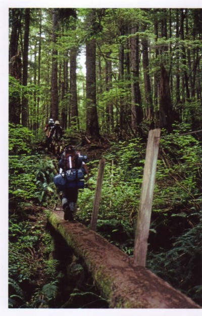
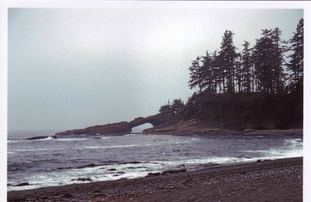
From the ferry, there was a steep climb and, shortly after the start of the trail, we passed the yellow sign with the number 75. From now on, this number should decrease continually. In contrast to the decreasing number of kilometres, the track rises steeply, over pieces of wood, stones, and roots. It is six kilometres to today’s destination , Trasher Cove. After only a very short time, my rucksack starts to press heavily. Sweat is streaming from my forehead. Why hasn’t there been another kilometre sign for so long? We carry on – up and down. The roots of the trees make it clear why this is rain forest. The roots go up man-high on the one side and down again on the other side, to the next root. At last! There is another small yellow sign. No, no-one has taken it as a souvenir.
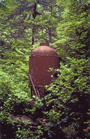
We have really only covered one kilometre. I need my first break. At Km 72, there are still machines from when the West Coast Trail was built – as a life-line for the shipwrecked. Shortly after that, according to our map, we reach the highest point of the trail. It carries on, the same as before, up and down. At kilometre 70, we reach a sign: Camper Bay 8 km. Trasher Cove is only one kilometre from here. Tomorrow morning, we must walk back along this one kilometre stretch. In the meantime, it is about 18.30. We take another break before completing the last kilometre for today. By now, it is already getting rather dark in the forest and, near our rest place, there is a sign ‘Cougar in this area’ At about 19 hours, we go on our way again. There’s only one more kilometre. In places, it is a steep climb upwards. My rucksack is pressing tremendously. While still in the middle of the forest, it starts to get rather dark. At some time or other, we smell the camp fires in Trasher Cove. The final part of the way consists of four ladder-systems leading down to the beach. By the time we reach Trasher Cove, it is about quarter past eight. With trembling knees, we let the rucksacks fall on the sand and take the next best place on the sand to set up our tent. While Annette fetches water, I erect the tent and put our things in their place. Annette withdraws into the tent for a while, while I start to cook our evening meal. With something warm in our stomachs, we gradually started to feel better. In the meantime, it had started to rain lightly. Before settling down in our tent, we put our food and toilet articles into the anti-bear container.
01 August Restday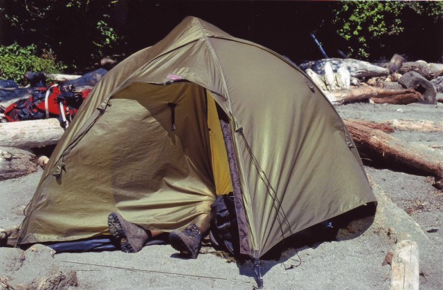
The next morning, the
weather is
wonderful again and we decide to spend the day in Trasher Cove.
Annette’s ankle
is protesting strongly against having to go any further. We want to give
it
a rest. Then we could also bring our travels diary up to date again.
First, we have to walk back the last
kilometre. By the time we reach where the trail forks to Camper Bay, we
are
already sweaty, through and through. Climbing down the ladders is not
really a
problem but, going up them very quickly becomes a tremendous effort.
The hope
that the trail will be easier today is an illusion. Then, from
Km
64, there are board-walks, so it is easier to make progress
and we reach
our destination for the day, Camper Bay.
About midday, we reach what was our
destination for yesterday, Walbran Creek. We wait for the tide to go out,
so
we can at last walk further, along the beach.
The way along the beach takes some
getting used to. With a heavy rucksack, one sinks deeply
into the loose
sand or gravel. When the tide is out, it is best to walk directly on
the
sea-bed. However, when doing this, one must be careful not to
slip on
the wet sandstone – which happened to me a couple of times.
But one carries on
walking, one’s trousers soon dry and even help one to cool
off a bit.
It
is a remarkable feeling
to walk directly across the bed of the sea. Where there was only a
uniform
expanse of water when the tide was in, there is now a landscape with
higher and
lower areas.
Towards
evening, we reach Carmanagh
Creek and decide to save the Indian café just before Km 44
until tomorrow, for
a second breakfast.
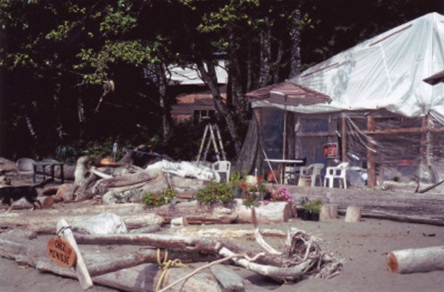
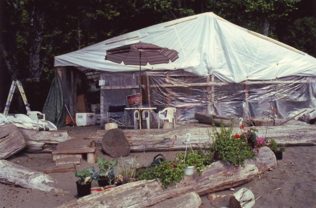
The second breakfast at the Indian
kiosk – which is mentioned in every guidebook for the West
Coast Trail – is
really an experience.
Because
of an attack by a bear,
camping is forbidden between Km 38 and Km 36. In spite of this, there
are still
a few people who erect their tents in this area, but we don’t
want to be woken
up by the paw of a bear. We want to end today’s stretch near
Km 34 where,
according to the map, there is an anchor on the beach – but,
unfortunately,
there is no access to the beach at that point. So on we go. We hope to
find a
place to stay for the night somewhere by the Nitinat Narrows. However,
the type
at the ferry is not exactly
friendly. He says that the
next possible place to stay overnight is one hour further up the beach.
Not a
piece of news to put me in a better mood permanently, as I really feel
I have
had about enough for today. A short distance from the track at about Km
31, we
find a small place -
on a cliff – where
we can put up our tent. As there is no water, we can’t have
an evening meal.
Dead tired, we crawl into our sleeping-bags and very soon fall into a
deep
sleep.
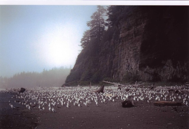
For the same reason, we have to wait for breakfast the next morning. We catch up on this on the beach, near Km 29. That would have been a better place to spend the night but, the previous night, I could not have gone any further, In comparison to yesterday, today’s stretch is very short. We want to reach the camping place by the Tsusiat Falls. When we arrive there, we can watch the seagulls bathing in the Tsusiat River. As is usual with gulls, a tremendous noise filled the air. As if they have been given an order, those seagulls which have just bathed in the river rise to make place for others. The way the gulls wash themselves is very amusing.
Under this date, among other
things,
the following is written in our travel diary: ‘Actually, we
had said on the
permit that we would be back today, but the ranger will just have to
wait an
extra day for us’.
The fourteen
kilometres went very
well. Most of the time, we could walk along the beach. Shortly before
Michigan
Creek, we met the
park patrol for the
first time. They helped us to pluck up courage
for the final
stretch. They said it would be no problem to walk the remaining twelve
kilometres in 3.5 hours. When they saw the look of doubt on our faces,
they
said there was one kilometre that could be walked in seven minutes. We
will
see.
When
crossing Michigan Creek, we
miss seeing the tree trunk across the river further
up and, at the end
of today’s stretch, I have got wet feet.
While
sitting in front of the tent
after our evening meal, we can watch whales blowing. Presumably, they
are grey
whales but, from on land, one can’t see clearly.
Today, we
want to check what the
young members of the park patrol said – whether, among the
twelve kilometres
that remain to be covered, there is one for which we
need only seven minutes. This last
stretch no longer goes along the beach – it goes through the
forest. Already
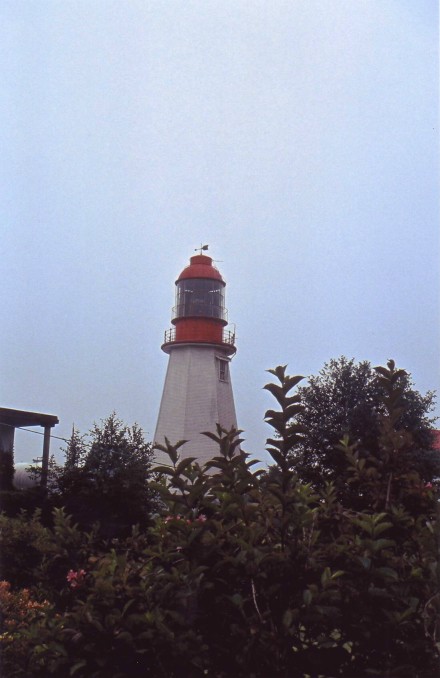
when we reach the Pachena lighthouse, near Km 10, we start to wonder
whether
the talk of three-and-a-half
hours was
not just to give us strength for this last stretch of the trail. For
the last
kilometre, there is a diversion. We had hoped that we had all the
ladders
behind us but here, in the last kilometre, we still had to go up and
down
several ladders. Originally, that must have been the kilometre that
took only
seven minutes.
At
14.06 hours, we reach the end of
the trail. We have done it. Completely worn out but full of pride, we
drop our
rucksacks in the grass.
After reporting back, we organized an overnight stay in Rosie’s Bed and Breakfast, and a taxi, from the end of the trail. On the drive from Trailhead to Rosie’s B & B, everything worth seeing and the most important places (general store, restaurant, pub) were pointed out to us – also the distances and the time needed to get to Bamfield.
After a shower, which both cleaned and freshened us, we set off on foot to Bamfield. We ended the day in the pub, with beer and fish and chips. There we also met many of our fellow-hikers from the past few days.
| 31.07. | Gordon
River –
Trasher Cove |
| 01.08. | Rest
day in Trasher Cove |
| 02.08.
| Trasher Cove – Camper
Bay |
| 03.08.
| Camper Bay – Logan
Creek |
| 04.08.
| Logan Creek – Walbran
Creek
– Carmanagh Creek |
| 05.08.
| Carmanagh Creek –
Kilometre 31 |
| 06.08.
| Kilometer
31 –
Tsusiat Falls |
| 08.08.
| Michigan Creek –
Patcheena Trailhead |
© Annette Baur and Reinhold Strecker , May 2006
Last alteration: May 09 2006